Monday, July 25th, 2016 – Sunday, August 7th, 2016
Monday, July 25th – Layover in Dallas:
I took off out of Grand Rapids around 8am on that Monday and landed at DFW around 9:30am. Because I had a 6 hour layover, I had contacted a friend of mine that I had met when I did a study abroad in Prague back in 2010. Jade and her mom, Laura, were available and agreed to take time out of their day to pick me up at the airport and hang out with me for a bit.
I really had wanted to go downtown Dallas, but they didn’t think that we would have enough time to that. So, they took me to this little quaint town called Grapevine which is just outside of the DFW airport.
We had breakfast first, then we wandered the main street of Grapevine just chatting and wandering in and out of shops. It was really cool to tour a little bit of Texas before they had to rush me back to the airport to get on my plane.
 |
| Downtown Grapevine |
 |
| The only pic I could get of Jade's mom - she's a dinkus! |
 |
| Me and Jade |
 |
| Best Tourist Picture Evar! |
They dropped me off at my gate and I got inline to go back through security. I was really nervous that it would take me forever, but since my checked bags were already in the system and all I had was my carry-on, I think I got through security in less than 30 minutes.
I flew from Dallas to Anchorage, changed planes, then flew on to Fairbanks. I arrived at the airport around 9pm. Fairbanks is one of the larger cities in Alaska, but I was shocked as to how small their airport was! I think it was smaller than the Grand Rapids airport….I say this because they only had 2 baggage claim carousals and GR has 3! Haha.
 |
| The prop plane that took me to Fairbanks! |
The hotel had their van pick me up and take me to the hotel, which was only a few miles away. I got in, settled down and let everyone know that I made it alive. I really couldn’t sleep, since I had slept the whole time on the airplanes, so I just watched TV and hung out. I figured that because I was so much farther North that it would be light a lot later than normal. Around midnight, it was still pretty light out, which I thought was kind of cool and crazy.
 |
| Almost midnight and it's this light outside!! |
Tuesday, July 26th – Day in Fairbanks:
That morning, I got up to wander around Fairbanks for the day. The town is so small, I figured I didn’t need a car and I would just walk everywhere. The first place I went to was this wooden bowl factory which I accidentally discovered was in Fairbanks. I’m so glad that I decided to go there! All their bowls are hand crafted and you can watch them make the bowl right on site. They use a computer and laser to burn pictures and words into the bowl. It doesn’t sound exciting, but I thought it was really cool. I purchased a few bowls and headed back out to explore.
My next stop was this place called Pioneer Park. It totally reminded me of some attraction that you would find along Route 66 back in the 70s. It looks pretty dated and kitschy, but I actually had fun touring the place! They had a lot of artifacts from the gold rush era and they had centennial homes from the pioneer days that you could walk through.
 |
| Well Hello, 1960! |
After Pioneer Park, I dropped off my purchases back at my hotel and then headed out for downtown Fairbanks. There was a walkway that ran alongside the Chena River that I could follow the entire way. Once downtown, I walked to all the little statues and markers that were on my tourist map that I got at the airport. One of the places I checked out was the Clay Street cemetery. It was really interesting and sad because most of the cemetery was filled with people who had come to Fairbanks in the early 1900’s when gold was discovered there. Some of the grave markers only had the person’s first name and date of death. It was incredible how many young men flocked to Alaska for gold, only to die suddenly in a terrible mining accident.
 |
| Clay Street Cemetery Entrance |
After that sobering tour; I started to head back to my hotel for the night. One the way back, I did come across this unique looking house that advertised selling Alaskan gifts. I went inside to check it out. I quickly realized that this house was full to the brim of nothing but crap. It was something that you would see in the movies. As I walked around, I didn’t even see one person, all I heard was odd banging from a distance room. After about 1 min I got the heck out of there before I was kidnapped and placed in the cellar! After that I just walked back to my hotel room, got some food for the night and organized all my hiking gear for the big meet up the next day!
Wednesday, July 27th – Flying to the back country:
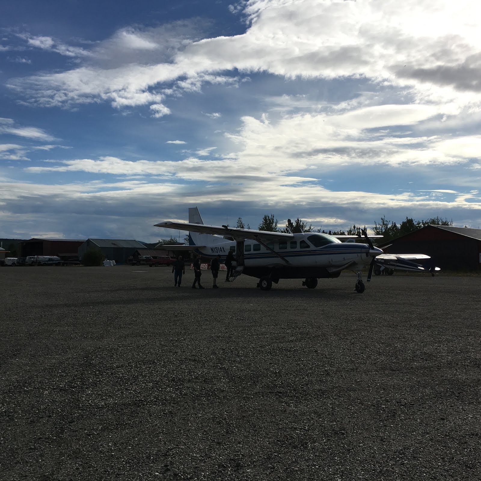
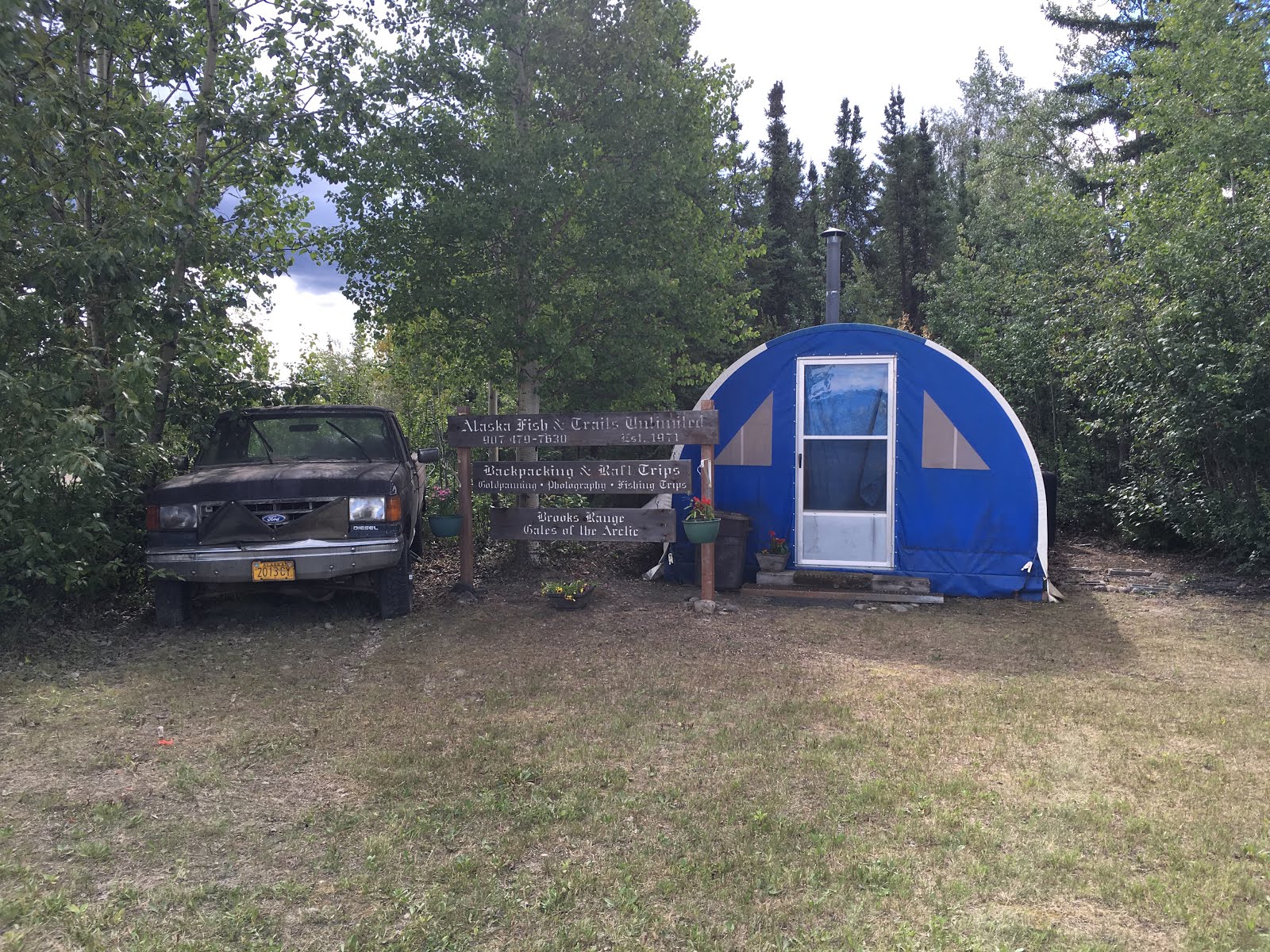
The plan was for me to meet up with Jule, the hiking guide, at Wright Air Service. This was a private air service that was connected to the main Fairbanks airport. Once I got there, I spotted Jule and 2 other hikers organizing their stuff. Stephanie and Giles were from New York and this was going to be their first Alaskan hike. After introductions, we got all of our gear ready to be loaded onto the plane. The ‘terminal’ consisted of 3 service desks, weight scales, 2 single bathrooms and a handful of seats to wait for your flight. Once inside, Jule got our flight information and we just waited. At this time, we found our other hiker, Sonya, who was from Wisconsin and it was her first time hiking in Alaska as well.


Late morning, the 5 of us and maybe 6 other people boarded a
plane headed North! The plane was so
small, that the flight was really turbulent for me to handle. I had to keep my eyes closed the whole time
so that I didn’t throw up! We made one
stop in some remote town, where a few of the people got off. After that stop, another 40 minutes or so and
we were finally flying into Bettles!
 |
| Plane to Bettles! |
This town is something I have never experienced before. There are no official roads going to this
town. The only way here is by
plane. In the winter, they do make an
‘ice road’ to Bettles from a distant highway, but that road didn’t exist when I
was there in July! The town has a dirt
air strip, a couple of lodges and a DNR outpost. Once we landed, we gathered our gear up and
took it to the Bettles lodge where we were supposed to meet our next pilot who
would be taking us out into the bush.
 |
| Bettles Lodge! |
We trekked over to the DNR office to have our back country orientation and get checked in with the park. The DNR guys just went over park rules and regulations, asked us what our itinerary was and got Jules backpacking license (which was a little bit of a hassle because she didn’t have it with her and she had to call Carl to fax it to the DNR – we were almost afraid that we wouldn’t even be able to go!). Anyway, after the DNR visit, we still had several more hours to wander and wait until our flight.
Finally, around 5pm our pilot was able to take us to the back county! We threw all our gear into this van, they drove us down to the float ponds, we unloaded at the dock, reloaded everything back into the float plane and climbed aboard! This plane was even smaller than the plane that flew us from Fairbanks to Bettles, so I really had a hard time keeping it together and not throwing up! After about an hour of torture, we finally landed at Circle Lake where our pilot dropped us off. When we landed, I noticed that Giles had sweat just streaming down the sides of his face. It wasn’t until we busted out of the plane that he said that he almost threw up too. I was glad that I wasn’t the only one who struggled!
 |
| Packing out stuff onto the float plane |
Once we got everything unload, our pilot wished us good luck
and that he would see us in 10 days!
When he flew off in his little plane, it was this weird surreal feeling
of really being out in the wilderness alone with 4 strangers for the next 10
days!
 |
| See you in 10 days! |
Since it was so late in the day, we decided to just set up
camp right there at the water’s edge.
After we set up camp, we hiked over to a small wooded area to leave our
pack rafting equipment for the next few days.
We didn’t want to hike all that way with stuff that we wouldn’t use, so
we bagged everything up, Jule scurried up a tree and we handed her the bags so
she could hang them in the tree. If we
would have left them on the ground, bears may have torn into them. Even though there was no food with the pack
rafts, the bears are just like dogs…they will be curious of the items and the
smells and tear into them just to see what they are all about. Afterwards, we just had dinner and retreated
to our tent for the evening.
 |
| Jule in the tree hanging our pack rafting stuff. Sonya, Giles and I watching her! |
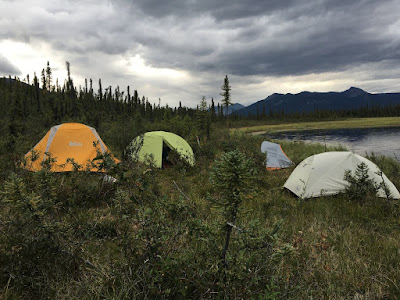 |
| Our first camp site |
 |
| Circle Lake |
That first night is when I discovered that we were so much
farther North of Fairbanks that it literally never got dark all night
long. It didn’t even get dark enough for
me to ever use my headlamp. When I would
wake up in the middle of the night to pee, I would look at my phone to see what
time it was because there was no telling if it was 1am or 6am. It was all the same amount of light! I
thought for sure it would get dark at some point between the hours of 1am and
5am, but it didn’t. I guess the good
thing was that we were never had to worry about getting to a certain
destination by a certain time because it never got dark. This was definitely the most bizarre thing
that I have ever experienced.
July 28th – Hike to the plateaus
The next morning we got up around 8 or so, ate breakfast,
packed up camp and headed out for our first real big day of hiking. Our goal was to get to this place called The
Plateaus. The plateaus were these two
rock formations that were perfectly flat on top and were maybe 4 stories tall
and a 5 minute walk from each other. One
plateau was to be used for our camp and the other for our kitchen. For 6 long, exhausting hours we hiked at a
gradual incline towards the plateaus.
Now, this doesn’t sounds too bad; however, there are no trails and my
pack was at its maximum weight of 50lbs.
We were averaging about ½-1mile per hour!! The biggest obstacles were
Tussocks. It’s like this ball of
roots/grass that grows out of the ground.
It looks like you could just walk across the top of them real
easily…like jumping from rock to rock across a creek…. but you can’t because
they are wobbly and you would fall off.
So, you have to stomp your way around them so that your foot hits the
ground and not the Tussock. After
crossing the field of Tussocks and pushing our way through some brush we came
across this ‘social trail’ or ‘game trail’.
Even though this trail is not maintained by the park or anything, it was
wonderful to finally have some kind of trail to follow. You really do not appreciate how helpful
trails are until you don’t have them!
Once we got to the trail, hiking was a bit easier, but we were still
gradually climbing which was hard. Just
when we were mentally and physically at our wits end, we reached the plateaus!
 |
| Heading to the plateaus. Crossing the dreaded Tussocks...it's way harder then it looks! |
 |
| Camp at the Plateaus - Pic courtesy of Sonya |
We set up camp on the first plateau, then trucked all our
cooking stuff and food over to the second plateau. After walking all day, we needed to fill up
all our containers with water. Jule,
Sonya and I headed back to the first plateau to grab our backpacks so we could
more easily carry our containers down to the river. Giles and Stephanie were going to take a
minute to rest before heading down for water as well. From the first plateau, you could look down
and see the river….it was just right there!
It didn’t look like that bad of a climb down, so we were wearing our
camp shoes instead of our hiking shoes (my camp shoes are Crocs…it’s nice to
wear a more loose fitting and breathable shoe after hiking for 6 hours in
boots).
 |
| Kitchen on the 2nd Plateau |
At first, there was a path that we could follow; however,
the path quickly disappeared, the landscape got very steep and the brush became
almost impassible. Jule was leading the
way through the brush the best she could.
Several times, she would tell us to stay put and she would venture
ahead; then she would call back to us and tell us how to traverse over the
landscape. At one point, we reached a
dry creek bed and worked our way down that for a several feet…since it was
actually clear of brush. Jule was
leading the way, I was behind her and Sonya was behind me. All of a sudden, Sonya calls out “Rock Rock
Rock!”. As I turned and looked up the
hill in her direction, this rock the size of a bowling ball came tumbling down
the creek bed. I turned and looked at
Jule, who quickly dodged this rock that would have hit her square in the head
had she not moved. For a brief minute I
had that weird out of body-this isn’t really happening-oh my god moment. All I could think was: How the hell would we
get her back up to the plateau if she was injured? Does anyone know where the satellite phone is
that she was carrying? After that
moment, we had to take turns going down the dry creek bed. Once she got to the bottom and moved to the
side, then I went down. Once I made it
down, then I called up to Sonya and she climbed down. During that time, a few more loose rocks came
tumbling down the creek bed, but we were on high alert and ready to get out of
the way.
After about an hour or so, we finally found our way to the
water to fill up our Nalgene bottles and water bladders. Since it was such a torturous ordeal to get
down there, I filled everything I had up to the brim so that we wouldn’t have
to do that again. I even have this
folding camping bucket and I filled that up as well. Jule and Sonya looked at me like I was
insane. There is no way that you can
climb back up there with a bucket full of water and in your Crocs! I figured we had to get as much water back to
camp as possible and worse case I would trip and dump the bucket of water
out.
 |
| The water isn't THAT far away.... |
 |
| We made it to water! |
Instead of going exactly back the way we came, Jule figured
we should just go straight up from the river.
It was steep, but there was no brush.
She wasn’t sure where we would pop out at, but anything was better than
going back the way we came. I dug deep
and plodded up this steep incline, in my crocs, with a backpack full of water
containers and a bucket full of 2-3 gallons of water. I felt like one of those pack mules you see
slowing trudging up a mountain side in Argentina with the giant bundles tied to
their sides. After about 20-30 minutes
we reached the top and my bucket of water was intact! We were sweaty, scrapped up from the brush
and exhausted. We had popped out at the
second plateau where our food and kitchen had been set up. Giles and Stephanie were sitting there
waiting for us. They had started to try
and catch up with us, but lost us on the way down to the river. They decided the best thing was to wait back
at the top for us to return and then go down together once we were back. We told them what all had happened and how
hard it was to get water. I told them
that I was so glad that they didn’t follow us down because how treacherous it
was and I was glad they had stayed back at camp in case something bad had
happened. However, since we found that
the way we had come up from the river was a fairly easy path to the water, they
just had to go down the way we had come up.
In no time they were back with more water and they exclaimed, “That
wasn’t so bad!”. It’s funny now, but at
the time I don’t think I shared in their excitement.
July 29th – Hike to the Valley of the Arrigetch Peaks – set
up camp for 3 days
The next morning, we packed up camp again and headed out. The plan was to get to the place where we
would base camp for the next 3 days.
Although we were still steadily hiking up on an incline, we were able to
keep following this ‘social / animal’ trail that made it somewhat easier. To our right was the Alatna River, so it was
great scenery and a nice break from staring at trees and brush all day. This day ended up being our 2nd
longest day of hiking. After about 6
hours or so, we took a break to assess where we were and how much farther we
had to get to our destination. Jule
checked her GPS and figured we had about 1.5 miles to go. We were tired, hungry, exhausted and just
wanted to be done for the day, but we trudged on. At this point, we broke away from the main
Alatna river and followed the Arrigetch Creek up into the valley where we would
be camping. After another 45 min of
walking, we crested this grassy hill and the valley came into view! There was the place we were going to set up
for the next 3 days! We were ecstatic! There is nothing better than talking off your
50 lb pack after carrying it for 7 hours.
We were all so tired that we set up camp and got our dinner going as
fast as possible. Afterwards, we
retreated to our tents around 8pm for the night, but I don’t think anyone
minded.
 |
| Making our way to the Arrigetch Peaks Valley |
 |
| Sonya taking a way better picture then me during a break |
 |
| My stuffing my face during our break. |
 |
| Blueberries were in season and we would always stop to eat them! |
 |
| Time to put your water shoes on and cross the creek and pray you don't fall! |
 |
| PS: the water was freezing! |
 |
| We are almost there! |
 |
| Camp for the next 3 days! |
July 30 – Hike to the South/West valley
The next day our plan was to take it pretty easy and just do some
exploring in and around in the valley where we were camping. We started out following the Arrigetch creek
upstream to where it basically disappeared into the mountains. Sonya and I started climbing up the rocks
where the creek ended….she was convinced that there must be a lake or some kind
of water source up in that valley. As we
climbed, we could hear rushing water, but most of time we couldn’t see it. We kept following the sound and eventually we
found where the water formed these cool little waterfalls as it rushed over the
rocks.
There were a few times when we were climbing that we would hear loud
crashes. Avalanches were very prevalent
in this valley. After poking around for
a little more, we eventually made our way back to the group and back to camp.
Later that evening when we were sitting around eating our dinner, I was
facing that South valley when all of a sudden I saw a huge movement along the
side of one of the peaks. I shouted
‘look!’ and about a second later we heard the crashing sounds. A huge avalanche had occurred in the valley
where Sonya and I had been earlier that day.
It was so big, that it created this dust cloud that hung over the valley
and took a while for it to dissipate. I
had never seen an avalanche like that before in my life! It was a little unnerving to think that just a few hours earlier Sonya
and I were climbing up in that area.
After dinner…I can’t remember if it was this particular night or not….but
I headed down to the river to rinse out my bowls from dinner. As I was quickly skipping over the rocks in
my Crocs, I fell. My pots, lid, spoon,
and shoes went flying. I picked myself
up and luckily none of my stuff went floating down the river! However, there was some left over beef broth
in the bottom of my pot and when I fell all that juice poured over me! Super, I thought. I’m in bear country and I just covered myself
with Au Jus so I’ll be real tasty when the bear eats me!
 |
| Heading to the South valley |
 |
| Sonya and I hiked up that valley |
 |
| This was were we later saw the big avalanche |
 |
| Heading back to base camp - the yellow dot in the middle was someone else's camp |
 |
| Home for the rest of the day at base camp |
July 31st – Hike to the west valley with the lakes.
The next day the plan was to hike up into the west valley where there
were said to be 3 glacier lakes. This
was my favorite hiking day because we followed a creek basically the entire
way. There were beautiful waterfalls and
lots of running water to hike next to.
Each lake we saw was the most crystal clear and bluest water I have ever
seen. The pictures really say more than
words ever could.
Once we reached the final lake, Sonya and I kept exploring around the
lake. Giles and Stephanie stayed back at
the foot of the lake and we ventured to hike around it. Sonya brought her camera gear and set up to
take some awesome pictures. I just
wanted to walk around the lake, so I continued on.
The lake was surrounded by these huge boulders, so in order to get
around you literally are just traversing boulders the entire time. I really like doing that; it’s easy…especially
when you don’t have a 50 pound pack to carry.
However, because I am a huge klutz, I really had to watch what I was
doing so that I didn’t fall and crack my head open. As I hiked, I kept saying over and over what
Gary said to me before I left, “Take your time and make good decisions!”
 |
| Stopping for some water. |
 |
| Resting at lake 1 |
 |
| Looking back at lake 1 and 2 |
 |
| Me at Lake 3 |
 |
| Heading back to base camp |
 |
| Dinner at our base camp |
Aug 1st – Hike to the NW valley following the river
Our final day at base camp was going to be back tracking to the Alatna
river and then continue following the river up the NW valley. This day was a fairly easy hike for me. We were mostly hiking over large rocks, which
I don’t have a problem with. I actually
preferred walking over rocks as opposed to over the ground! It was also fairly cool that day during our
hike, because we were walking along the south side of the river, but along the
north face of the side of the valley, so we were in the shadows of the mountain
for most of the day. Because we were so
far North, it’s like the sun doesn’t really reach it peak until 2-5pm. We hiked for a few hours until we found a
perfect little grassy spot to chill out on the mountain side and sit in the sun
talking for a while.
After sitting for a while, we decided to head back. We knew this was our last relaxing day before
we headed back down to lake where we started.
We were about halfway back to camp, when Jule decided to stop at a flat
spot and wash her hair in the river.
Stephanie and Giles decided they were going to do it too. I didn’t care how greasy my hair was, I was
not about to freeze my butt off because that water was ice cold!
That evening we kind of started gathering up our stuff knowing that we
had a long day ahead of us tomorrow.
Jule got out her GPS and maps to show us how we were going to tackle the
next day. It was then that she realized that
the batteries in the GPS were really low.
She had back up batteries but you needed a tiny Phillips screw driver to
get to the batteries and we did not have anything like that in our gear. The batteries were so low that the GPS kept
shutting off…..eventually, they completely died. She assured us that she could get us back
down with no GPS solely on Carl’s hand written instructions. It was not until just then that we realized
that she had never even hiked the area before.
She had been guiding all of us this whole time based on Carl’s paper
maps and a GPS whose batteries were dying.
I was a little shocked, but she was so natural at guiding and I thought she
had done this route many times before that I never would have guessed she was winging it!
 |
| Last hike from base camp |
 |
| Our little piece of property we found to rest |
 |
| These crazies are washing their hair! |
 |
| Last hike back before we leave base camp for good |
Stay tuned for Part II! Sorry for all the weird spacing....not sure what the deal is.