ISLE ROYAL HIKING – MAY 24-MAY 31
Friday, May 24th
I decided that I would drag Gary to Isle Royal for some hard
core hiking. We were planning on heading
up North on Friday. However, I had
already signed up to help at a career fair at one of the local elementary
schools Friday afternoon for a few hours.
After the career fair, I met at Gary’s house and we took off for the
UP. We made it all the way to Marquette where
we were planning on staying the night.
Saturday, May 25th
The next morning, we left Marquette early to make it to
Houghton / Hancock by 9:30 for our 10am flight to the island. We made it to Houghton without incident. We got to the float plane docks, parked,
unloaded our stuff and waited with the handful of other people wanting to head
over to the island. The weather in
Houghton was sunny and cool and a little windy.
Unfortunately, the pilot informed us that heavy fog in Windigo Bay was
postponing flying people to the island and picking up people waiting to leave
the island. At first, I didn’t think
much of it. I have flown to Isle Royal before
and I knew that weather could be an issue.
Since it was so early in the morning, we just figured that the fog would
lift and we would fly to Windigo later in the day. The pilot did suggest that he would fly
people to Rock Harbor if anyone wanted to hike their route backwards. Some people took him up on the offer, but we
decided to take our chances and hold out.
In the meantime, we waited around for an hour or two. Just hanging around and sitting in the back
of my jeep playing cards. Around noon we
checked back in with the pilot. Now he
said that the wind was too high for him to take off and land, but to check back
in with him around 2pm. So, we headed
back in to Houghton and ate and walked around downtown a little Around 2pm we checked back in. The pilot again said it was a no go. Now we were worried. This delay was really throwing off our whole
hiking schedule. The pilot said that the
last shot would be at 5pm. So, we
decided to head back into Houghton again and wait around until 5pm before
making a final decision. We went to the
Keweenaw Brewing Company to sit and have some beers while we waited. We ran into this couple, Bethany and Keith,
who were waiting to fly to Isle Royal as well.
They were a little panicked too.
They didn’t know what they were going to do. We chatted a little about what our options
were. Around 5pm, we told them that we
were going to check in with the pilot one more time and we would text them what
he said.
When we got to the float plane docks, the pilot was not
there, but this couple was sitting there waiting to fly to Windigo. We chatted with them a little and told them
what was going on with all the delays.
They mentioned that they basically lived on the island in the summer and
their regular home on the mainland was closed up, so they didn’t really have
anywhere to go if they couldn’t get back to Isle Royal. I asked them what they did on the island and
the woman said that her and her husband studied the wolves and the moose on the
island and that they had been doing that for years. I knew about the famous wolf/moose study that
is done on Isle Royal and that there was ‘this guy’ who wrote books about it
and was kind of the head of the study.
At the time, I thought that maybe her husband was ‘that guy’, but I
didn’t ask them their names or anything.
We just chatted some more until the pilot returned to the docks with the
news that we all did not want to hear.
It was still too windy and he just could not fly out. We would have to fly out on Sunday, the 26th
pending good weather. Gary and I got on
the first flight we could Sunday morning.
However, now we had lost an entire day of hiking. The plan was to hike from Windigo Bay to Rock
Harbor across the entire length of Isle Royal.
That would mean we either double up a hiking day to make up the distance
or we push out our pick up day. We had
to make a decision right then, because we would not be able to communicate to
the pilot once we were on the island. We
decided to play it safe and push out our pick up day from Thursday to Friday,
May 31st. So, we packed up
all our stuff, found a hotel, and hoped that we would be able to get to the
island the next morning.
Sunday, May 26th
Sunday morning we got to the float docks at 8am for our
flight to Windigo Bay. The weather
appeared to be perfect on the mainland and the pilot confirmed that all was
well on the island too so we would be flying over that day! The pilot / owner of the business had 2
planes running that day. One only held 3
people and the other held 8. Gary and I
ended up on the bigger the plane with the 2nd pilot, Bethany and
Keith, and the older couple that we had been chatting with the day before. Bethany started talking to the older couple
and realized that they were the famed Rolf Peterson and his wife Candy. Rolf and his wife are the main wolf/moose
researchers for Isle Royal. That was
actually pretty exciting to realize who we had been talking to.
 |
| The Portage Canal Lift Bridge |
 |
| Isle Royal Sea Planes Docks |
 |
| Gary, Rolf and Candy Peterson and me |
The flight over went well.
The weather was sunny and cool and the sky was clear to see all
around. Once we landed, the first thing
we had to do was check in with the DNR.
You sign in with the Ranger, telling them where you plan on hiking and
camping, how many days you plan to be there and so forth. We also had to do a quick orientation of the
island before we were free to go. After
we got our permits and were all set there, we headed to the camp store to get
fuel (you cannot fly with fuel, so you have to plan to buy it there once you
land). We filled up the canisters with
white gas and took off for the trails.
It was at this point that we said goodbye and good luck to Bethany and
Keith. They were crossing the island as
well, but they were taking the Greenstone Ridge trail which runs along the
center of the island.
When we checked in the Ranger said to us, “Wow, you guys are
hiking the most difficult trail on the island”.
The hardest I have ever hiked previously was while I was on my Alaska
trips. Little did I know that these next
few days of hiking would rank up there with the difficulty I experienced in
Alaska.
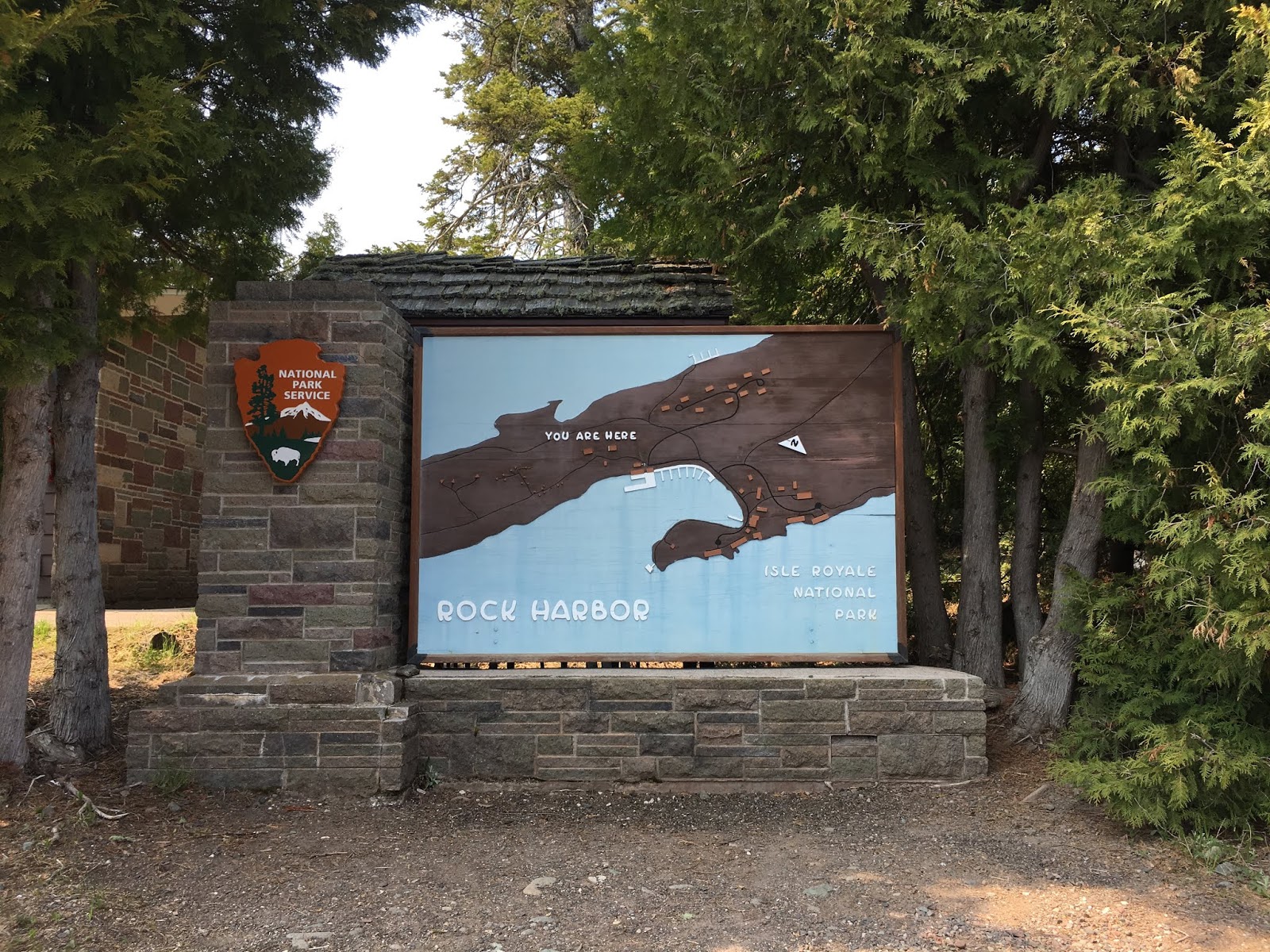
The goal for the day
was to hike along the Minong Ridge Trail to North Lake Desor and camp there for
the evening. When we finally started
hiking it was around 11am. The first few
miles were pretty easy. It’s fairly flat
and since there are lots of trails in the area, there are many markers. However, once we got on the main Minong Ridge
Trail, the real difficulty set in.
 |
| Flying over to the island! |
 |
| One of the many islands of Isle Royal National Park |
 |
| Inside the Ranger Headquarters at Windigo Bay |
 |
| We look happy and ready to go! |
 |
| Here we go! |
 |
| Because the beavers keep altering the landscape in this area by building dams and backing up the water, they had to create a weird work-around trail |
Most of the time we were hiking over outcroppings of
rocks. When you hike over rocks, you
have to look for ‘Carins’ which are strategically placed piles of rocks that
the DNR puts up to mark the trails.
Usually, the Carins are very easy to spot because they stand out from
the rest of the rock formations.
However, since this trail is not taken very often, the Carins are moss
covered which make them difficult to see.
They just blend in with the surroundings. Also, the trail went up over the rock
outcroppings and down off of them and then up over them again and down from
them. There were times I basically had
my hands to ground as I ‘climbed’ up the rock formations to follow the
trail.
When hiking, you can figure that you hike around 2 miles an
hour, but that’s if the trail is fairly flat and easy to follow. Around 4-4:30 we started to be able to see
the lake through the trees. We figured
we were so close now! Coming our way up
the trail was 2 girls. As they passed us
they stopped to let us know that there were 2 moose up ahead in the woods. We asked them where they were coming from and
where they were headed. They said they
were coming from North Lake Desor and that they were headed to Windigo
Bay. We asked them how much further to
the Lake and they casually said, ‘Oh about an hour, hour and a half”. Then we said our good luck and good byes and
went on our way. I thought I was going
to cry. We thought we were really close
and it was almost impossible to believe that we still had that much time before
we would get to our destination. On
another note, I was really worried about those girls! They started their hike so late in the day
that I was hoping that they made it to the Bay ok.
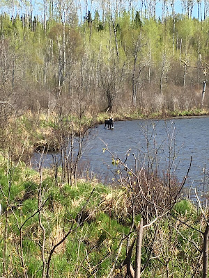
Anyway, we continued to plod on when all of a sudden I saw
movement through the trees. At first I
thought it was a couple of hikers and I was actually annoyed that we were going
to run into more people. But as we got
closer I all of a sudden realized that it was the 2 moose that the girls had
mentioned to us! I turned around to grab
Gary’s attention. We slowly crept along
getting a little bit closer to the moose.
Eventually, they just disappeared in the woods as we hiked along, but we
were able to get some good pics and video.
 |
| Moose! |
 |
| Looking out over Lake Superior |
 |
| Hiking over the rock outcroppings |
The moose sighting
had given us a little bit of a pick-me-up to keep going, but we were really at
our wits end. It was around this time
that the swearing really kicked in. In
the end, we did not reach camp that evening until 6pm. All in all, we hiked 12.9 miles in 7 hours
with 40 lbs on my back.
It was such sweet relief to finally get to camp and dump our
bags. The first thing I did was dig
through my food bag and pull out 2 little bottles of alcohol and hand one to
Gary. After we guzzled our drink, we got
busy setting up camp, filtering water and cooking dinner. As we were cooking and eating dinner we saw a
squirrel running around trying to get a snack.
After a while we noticed he climbed up in to the tree right above
us. He was pulling off the leaf buds and
dropping whatever he wasn’t eating. It
really seemed like he was purposely throwing stuff at us because we didn’t feed
him! Or maybe we were just hallucinating
because we were so tired. By 9pm we were
already laying down in bed for the night.
 |
| FINALLY getting to the trail head of Lake Desor. |
 |
| North Side of Lake Desor |
 |
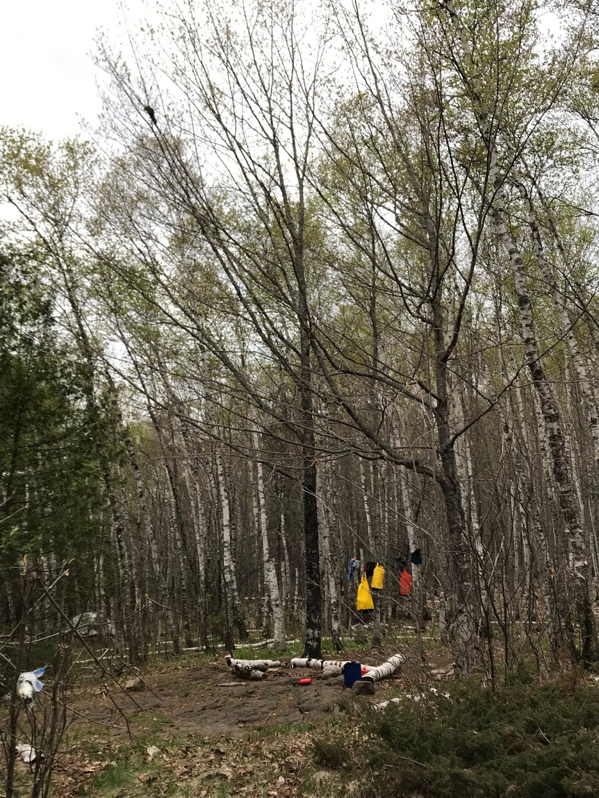
| Our campsite at Lake Desor |
 |
| If you notice in the top left of the picture there is a squirrel. I swear that little bugger was up there pulling leaf buds off the tree and dropping them right on our heads while we tried to cook dinner and eat! |
Monday, May 27th
The next morning came way too quickly. We had slept almost 12 hours and we were
still tired from the day before. We ate
and begrudgingly packed up our stuff for another long hard day of hiking. Our goal was to get from North Lake Desor to
Todd Harbor. The first section of the
trail was 4.6 miles to Little Todd Harbor.
That section of the trail was just as hard as the Minong Trail had
been. Up and down, over rocks, looking
for Carins, and trying to follow not-so-well-defined trails through the
woods. The DNR had warned us that
Beavers were transforming the area by creating dams, flooding different areas
and moving the trails. Not too far into
our day, we came upon the biggest beaver dam I had ever seen. It was so magnificent it actually looked like
machines had come in and built the thing.
Since the trail ended and we had to figure a way over this dam/creek, I
left Gary to stand on the end of the trail as a ‘bookmark’ and I ventured
across looking for the other side of the trail.
Once I found the other side, I then called to Gary to come over towards
my voice. It’s a good technique to use
so you don’t lose your way off the trail when crossing large flooded areas that
are not clearly marked.
 |
| This dammed up area was huge! It sincerely looked like a machine moved all those logs into place. |
 |
| The most amazing animals on Isle Royal have to be the beavers! And they must be Jurassic Park size since I am standing next to where they would have been chomping on the tree! |
 |
| Seriously, it looks like a machine created these wood chips |
 |
| I did find a beaver jaw. The teeth are massive |
After around 3.5hours of hiking, we finally made it the 4.6
miles to Little Todd Harbor. This was
basically our first real break and not even halfway to our destination. No sooner had we dropped our packs to eat,
pee and rest, then 2 guys came through the woods from the opposite
direction. We chatted with them for a
bit asking them about the trail up ahead.
They assured us that it was ‘easy’ and they had made the 6.6 miles from
Todd Harbor in 2.5 hours. Then they
happily trucked on past us towards the hell that we had just emerged from. Gary and I were pretty skeptical about the
next leg of the trail being ‘easy’. We
just assumed since these guys were in their young 20’s that the trail was easy
for them and we were still going to die.
 |
| Gary didn't have to say a word for me to know how he felt about this whole thing... |
Miraculously, the trail was not bad at all! We actually made it to the Todd Harbor trail
head in about 2.5 hours. At the trail
head, we only had 1.4miles to the lake and the campsites and that last mile was
super easy. Grand total for the day was
11.2 miles over 6.5 hours of hiking.
The campsites at the harbor were really nice and our site
was super close to the lake. As we were
setting up our camp for the evening, Gary and I froze as we watched a large fox
trotting by on the path. He stared at
us, while we stared at him. We were in
such shock that we didn’t even get a picture!
It was pretty amazing to see a wild fox though. The DNR had warned us to make sure to keep
our boots close by while at camp. Fox
have been known to grab a hiker’s boot for a toy and run off with it!
 |
| Campsite at Todd Harbor |
 |
| Todd Harbor in the morning |
There were a few guys camping nearby in one of the lean-to
cabins. They invited us over to enjoy
their fire, but we were so dead tired we just ate and crashed for the evening.
Tuesday, May 28th
The next morning we felt pretty good since the day before
had been slightly easier than the first day.
We got up, started packing up and I went down to the lake to filter
water. A couple of the guys from the
other camp were there too. I asked them
where they had come from and they said McCargoe Cove. That’s the direction we were going, so I
asked them about the trail and the difficulty of it. They said it was not bad at all. That statement gave me a little bit of hope
that the day would not be too bad.
We took off towards McCargoe Cove around 10:30am. The trail was actually what a normal hiking trail should be. Fairly flat and easy to see. We made it to the Cove in around 4 hours without incident. Our spirits were high because from that point, we only had 1.6 miles to go to our destination for the day and it was only 2:30! We really lollygagged that next mile and half. We stopped to look at some beaver tree damage. We stopped at another beaver dam / lake to watch some cranes walking around. At first the trek wasn’t bad, but because this segment of trail was heading up onto the ridge of the island, it became quite a difficult hike. It really didn’t dampen our spirits thought because we knew we only had to go a short distance!
 |
| Since it was early spring, we found a lot of shed antlers on the trail |
 |
| Unbelievable beaver dams |
At some point, we both stopped because we heard some
rustling in the woods. Nothing happened,
so we continued on. All of a sudden, the
next thing I know I hear branches crunching and breaking, I see part of a leg
and part of a body go crashing into the woods.
Gary and I froze. I guess we
spooked a moose. We stood there for a
second whispering about it. Then we hear
this super loud nose snort. Wide eyed,
we decided to get the heck out of there before Mr. Moose got really pissed!
As we made our way along, we eventually came up on this guy
heading in the opposite direction.
Straight away he let us know how disappointed he was that we got in the
way of him filming the trail. Then he
told us that up ahead were several moose and he saw a baby. I didn’t get my hopes up too high because we
didn’t know how far back those moose were and by the time we would get there,
they could be long gone. We finished
exchanging trail information then went on our way. We crested this little hill on the trail and
finally came upon Chicken Bone Lake.
I immediately froze.
There, just off the trail standing in the lake were 2 moose. We just stood there staring at them for what
seemed like forever. I didn’t want to
spook them, but we couldn’t stand there forever staring at them and besides
there was a guy coming the opposite direction so they were going to get spooked
regardless.
As we slowly walked closer, one of the moose took off swimming across the lake. The other one decided to go in the opposite direction and cross our hiking trail. At one point, he did seem to jolt and start trotting a few steps before stopping. We didn’t see a baby and I didn’t know if this was the mama or not, since it was so early spring and the male moose don’t have their antlers yet. I didn’t know what he was going to do and if he felt threatened or not. We stopped and waited for him to cross the trail and go off into the swamp which was East of the lake. I gripped my whistle and told Gary that if he charged, I was going to blow that thing as hard as I could to hopefully scare him into staying away from us. No drama came of any of it thank goodness. He just crossed the trail and went off into the swamp without incident.
 |
| Moose at Chicken Bone Lake |
 |
| This one decided to go for a swim away from the annoying humans |
 |
| This moose decided to cross our path, so we waited for him to cross and get a little farther away. |
From the Lake, the trail went up quite steeply to the camp
sites. When we got up there, we saw a
group of guys looking like they were half dead.
They were trying to decide if they were going to stay or if they were
going to hike on the McCargo Cove. I
desperately wanted them to leave, because there were not enough campsites at
East Chickenbone. Two of the sites were
already claimed for the night and there was no way in hell I was walking one
more step that day. In all honesty, I
wish we had stayed at McCargo Cove. The
camp was a lot bigger and nicer. It was
right next to the water too. And for the
guys, the trail would mostly be downhill for them heading that way. They decided to take my advice and take
off. We luckily claimed the very last
site at East Chickenbone.
So far, we had been really lucky with our campsites. East Chickenbone was my least favorite
spot. There were only 3 sites and they
were not even close enough to the lake to see the lake. You had to walk down this very steep trail to
get to the lake to filter your water. We
drug all of our stuff down to the lake to filter water and cool off a bit.
Once we filled up all our bottles and Camelbacks, I filled
up my bucket to take water back to camp.
That was the hardest ¼ mile I have walked in a looong time: Walking up hill, in Crocs, with a bucket of
water that I am trying not to spill. Once we got to camp with our precious
water, we got stuff around for dinner and to relax. I took off my Crocs to dry off my feet and
noticed I had this little black leaf stuck to my foot which wouldn’t come off. When I saw it move, I realized it wasn’t a
leaf but a leach!!!! I have never ever
had a leach on me and I didn’t know what to do!
Luckily, I was able to pick him off without much effort.
The rest of the evening was pretty uneventful. We were dead tired again from a long day of
hiking. Grand total for the day: We hiked 8.9 miles from Todd Harbor to East
Chickenbone Lake in about 6 hours.
 |
| Campsite at Chicken Bone Lake |
 |
| No Gary, there isn't a hotel over there, you're just hallucinating again. |
Wednesday, May 29th
The next morning, our spirits were high. We had a short day ahead of us and we were up
on the Greenstone Ridge trail. At this
point in the trail, I was familiar with what lay ahead for us. I had hiked this stretch before. I knew that this part of the trail would be
fairly flat with a little up and down, but not much. And I knew that once we hit the trail head to
Daisy Farm, it was a gently slope downwards.
Things started off good.
The hike was really easy compared to what we had experienced the last
few days. We started passing more hikers
at this point, since we were on a higher traffic trail. At one point, we passed these 2 girls and we
stopped to chat real quick. They updated
us on what we could expect and we updated them as to what they could
expect. No big obstacles for us, so that
was good. However, as we plodded along,
Gary started to complain about his foot.
He said his Achilles tendon was really bothering him. It felt like something in his shoe was
digging into him. At first, I just thought
he was being dramatic and was just tired.
However, as we walked on, he walked slower and slower until he finally
said he just couldn’t take it anymore.
We stopped and he took off his boots.
His one foot looked a little swollen.
I didn’t know what to do. We
still hadn’t reached the Daisy Farm trail head and I knew once we reached that
point, we still had about 2 miles to go.
 |
| It was right around this time when Gary finally gave up the boots for the Crocs |
We used some of my first aid bandages to wrap his ankle to
see if that helped. After a short rest,
we continued on at a very slow pace.
Once we finally hit the Daisy Farm trail head, Gary had to sit down
again and take his boot off. He said he
was just in too much pain. I was
desperately thinking that I could walk to Daisy Farm, drop off my load, then
walk back and carry Gary’s load for him while he just hobbled along. As we sat there trying to figure out what to
do, we discussed Gary just wearing his Crocs for the next 2 miles. It sounded crazy and impossible, but we
really had no other choice. So, Gary put
on his Crocs and I tied his boots to his pack and we started off.
Instantly, Gary said it felt so much better not hiking in those
boots. I was so worried he was going to
twist an ankle or slip or something, but he hiked the last 1.6 miles to Daisy
Farm without incident in his Crocs! In
total, we hiked 6.1 miles from East Chickenbone to Daisy Farm over 4 hours.
This was our earliest day and we were so happy! Once we got to Daisy Farm, we walked around
until we found the perfect lean-to to set up camp. We spent the rest of the day relaxing,
eating, laying in the sun on the docks and reading.
 |
| Gary and his famous Crocs |
 |
| On the Daisy Farm docks looking back at the campground |
 |
| So happy we got a shelter with a picnic table! |
Thursday, May 30th – Last full day of hiking
We got up early so we could get hiking right away. We only had 8 miles to go and I knew the
final trail would not be difficult at all.
However, because Gary’s boots were bothering him so much and his foot
was still swollen from the day before, we decided that he should walk in his
Crocs the whole way. I was really
nervous that he was going to twist an ankle.
So, I packed everything I could in my pack so he didn’t have to carry a
lot. We didn’t know how slow we would
have to go, so getting an early start was important.
 |
| Most of the old mines just look like this |
The trail was fairly flat, but there were a lot of roots and
wet areas because it was early spring.
However, Gary hiked along just fine with no issues! And before we knew it, we were walking into
Rock Harbor around 2:30-3pm. He had just
hiked 8 miles over 5 hours in Crocs with no incident! I couldn’t believe it, but I was also
relieved that we had finally made it!
Our treat to ourselves was that once we hit Rock Harbor, we
wanted to stay at the hotel there so we could be warm and shower. We ended up renting a ‘cabin’ for the
night. The actual hotel wasn’t open for
the season yet, so they rented out the summer staff quarters as cabins. I did not care at all! We were so happy to get the cabin, dump our
stuff and take a shower finally!!
After cleaning up a little, we just casually walked around
Rock Harbor for a few hours. We turned
in our left over fuel, checked in with the DNR and bought some stuff at the
camp shop. Gary bought a couple of beers
to celebrate the completion of his first real big hike. The restaurant, charter boats, etc were not
fully open yet, so there wasn’t too much for us to do or see. There were a few old mines, but really they
are all caved in and the foundation at the surface is all you really see. We mostly just sat in the cabin napping and
reading old books that they had there.
 |
| Our cabin for the night |
 |
| The famous Crocs that Gary walked a total of 10 miles in with no feet issues! |
Friday, May 31st.
The next morning, we were ready to go home. The cabins were really close to the dock
where the plane would be picking us up.
We took our stuff down there around 8am.
The small plane arrived and dropped off a guy for the start of his
hike. As he passed each other, we said
HI real quick and noticed that his accent sounded like he was from Russia. He said he was and we told him about how we
visited there and we used the 2 Russian words that we knew on him. He chuckled and we told him good luck during
his hike.
The flight back to the main land was pretty uneventful. The weather was great, so we had no
delays. We landed just fine, unloaded
all our stuff, piled it all in the Jeep, changed our clothes into the clean
ones that we had squirreled away and set out for our long drive home.